Sunday 29 June 2014

10. Raton, NM to West Pueblo, CO (Part 2)

10. Raton, NM to West Pueblo, CO (Part 2)

Here is a paragraph describing the Skyline Drive from a site named “City-Data.com. http://www.city-data.com/articles/Skyline-Drive-Canon-City-CO.html
Skyline is not for those who have never experienced a high road with cliff edges. It can be quite thrilling for those who seek adventure. A small car or truck is best, and the road should not be attempted by motor homes due to the grade of the road and the sudden turns required. Most of the road also does not have guardrails, which means visitors can peer out of the car directly down, and get a sense of what it was like to travel the road in the early 1900's, when cars were a little less sure footed. It is best to take the speed limit at heart to avoid any issues. There are a number of pull offs for the views and to catch your breath from the twisting road.”

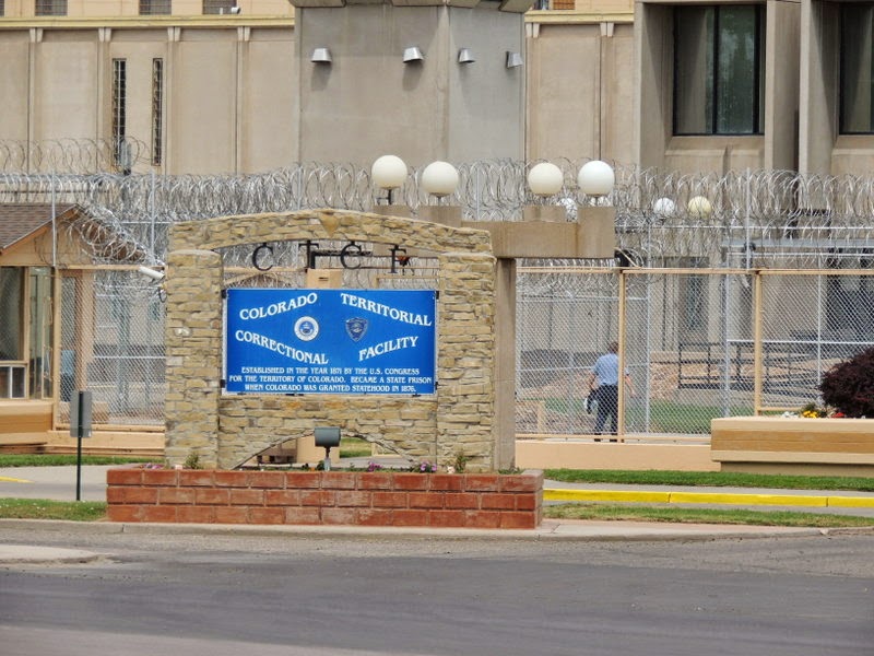
The road was built in 1905 by prison inmates who received a 10 day reduction in their sentence for every 30 days they worked on the road.  There is an arch at the entrance to the road. The arch was build using stones from every state in the union.

We drove this road several years ago. I was anxious to get back and take some pictures of it.


As you approach some of the crests it looks like the world ends right there. It is not a long road but well worth taking.

There are more pictures at: https://jackbarbic.shutterfly.com/8864


We drove to Colorado Spring to visit the Garden of the Gods. The land was owned by Charles Elliott Perkins and when he died in 1909 his family gave the land to the City of Colorado Springs on the condition that it would be a free public park. Across the street from the park is a Visitors and Nature Center. There is a non-profit Garden of the Gods Foundation that maintains and makes improvements to the park.

The rocks have been given names, there are signs around the park to help the visitors identify them.


Here is the view from the Visitor and Nature Center. That is Pikes Peak in the background.


There is a rock known as White Rock (#5 on the sign). As I looked at it I seemed to see a buffalo at the top of the rock. What do you think?


The park allows rock climbing; however, you must be a registered climber and have the appropriate equipment. We saw several climbers. These two were climbing the North Gateway Rock.


Another couple was climbing one of the Cathedral Spires. You may have to click on the photo to enlarge it enough so you can see them. I’m including some close ups. 


Nature weathers these rocks and creatures take advantage of what nature offers. Here ia home for a couple of pigeons.


Here are the Kissing Camels. Sentinel Rock is made up of a fine sandstone and a gravel conglomerate. The rock layers were horizontal when they were created but up lifting of the land now have them in an almost vertical position. What enormous forces exist in nature.


The most popular formation in the park is Balanced Rock. In past years when the land was privately owned, people were charged to see and have their picture taken at Balanced Rock.


There are more pictures of the Garden of the Gods at: https://jackbarbic.shutterfly.com/8762


10. Raton, NM to West Pueblo, CO (Part 1)


10. Raton, NM to West Pueblo, CO (Part 1)
We left Raton going north on I-35 over the Raton Pass, elevation 7835 feet and had a pleasant drive to a campground in West Pueblo CO.
From Wikipedia: Ratón Pass is a mountain pass on the Santa Fe Trail along the Colorado-New Mexico border in the United States. Raton Pass is a federally designated National Historic Landmark. Ratón is Spanish for "mouse." 


About 3 million years ago the uplifting of the land that today is the Rocky Mountains began. At that time, a river now named the Arkansas River began erosion of the rocks and over the years formed the Royal Gorge. It is a steep, deep and narrow canyon. Today there is a sightseeing railroad that runs through the canyon. The story of the building of the railroad and the Railroad Wars, between the Denver & Rio Grande and the Santa Fe Railroads is worth reading. You can access it at: https://www.royalgorgeroute.com/index.php/about-us/our-history/ And a more colorful version at: http://en.wikipedia.org/wiki/Royal_Gorge_Route_Railroad
In 1998 the Royal Gorge Express, LLC (RGX) purchased 12 miles of tracks through the gorge and began passenger service as the Royal Gorge Route Railroad.
An old and current engine.


The train goes through a bit of Canon City and then into the canyon, the sights are terrific. As the rides proceeds you see place after place where you would like to be. However, there is one exception.


The tracks parallel the Arkansas River. There are class IV and Class V rapids for the rafters. We saw rafts in the calm and rapid parts of the river. In one instance we saw a couple of people bounced out of their raft. I wasn’t fast enough to get that picture but I did get pictures of the people being pulled back into the raft.


It is common to get waves between the rafters and the train riders. What was unusual was to get a full moon.


The train had two open air cars. I spent most of the time there. The views of the canyon walls were exceptional. We did see some big horn sheep and a one man mining operation.


As you ride into the canyon you see remnants of a wooden pipeline. It was built in 1906 using prison labor. The pipeline started 7 miles upstream from Canon City. There was a dam where water was taken from the river and diverted into settling tanks to remove sediments. The wooden pipeline was made from redwood planks bound with metal strips and wire. It was essentially a very long barrel. Once a year sawdust was introduced into to the pipeline to seal any leaks. The pipeline had to be inspected every day and in some places you can see a plank next to the pipeline the men had to walk to properly do the inspection. Since this was a done year round there were huts with supplies in case the men were caught by a storm and needed shelter. We saw a Long Horn Sheep lying behind the waterline in one spot.  There were places where the builders had to blast tunnels to route the pipe line through. You can see holes that were the entrance and exit of these tunnels.

  If you are interested, here is a link to the Canon City pipeline: http://fotar.org/projects/royal-gorge/royal-gorge-old-water-pipeline/ and another on Vintage Wooden Water Ducts: http://www.pinterest.com/hcloete/vintage-wooden-water-ducts-storage-facilities/


The train stopped under the Royal Gorge Bridge. The canyon is about 1000 feet deep at this point. There is an incline railroad that is the world’s steepest, its length is 1550 feet and takes five and one half minutes to make the trip. Here at the narrowest part of the canyon blasting a railroad bed out of the perpendicular granite walls was impossible.  It is believed that an engineer, Shaler Smith conceived the “Hanging Bridge” whose construction began in 1878. More information can be found at: http://www.canoncitydailyrecord.com/ci_20160127/hanging-bridge-an-engineering-marvel-1878-..


On June 11, 2013  a fire started on the south side of the canyon. The high winds helped the fire jump the canyon and destroy 48 of the 50 buildings in the Royal Gorge Park. Fortunately the bridge sustained only minor damage losing 32 of its wooden planks. The following pictures shows some of the burnt trees


After the train ride we drove to the Royal Gorge Park. The park has limited access since the rebuilding is in process. After parking we boarded a bus that drove to the bridge, stopped for pictures in the middle of the bridge, then continued to the other side. I would like to return here after the reconstruction is finished, the new park is going to be great.


Looking down


The bridge was constructed in 1929 and closed to traffic in 1982-83 for refurbishment.  According to Wikipedia new cable anchors were installed. The original rusting cable ends were replaced by new multi-strand cables and then each of the 2,100 strands of existing suspension cable were spliced together with the new anchor cables. The bridge also got new floor timbers, wind cabling, and improvements to the bridge towers. “

I took a couple pictures of the cables. If you look close you can see wires twisted together in the second photo. There are some stories about bungee jumping and one gory story about a “wingsuiter” at: http://en.wikipedia.org/wiki/Royal_Gorge_Bridge


More pictures of the Royal Gorge at: https://jackbarbic.shutterfly.com/8888
End of Part 1