Wednesday 17 August 2011

The end of the caravan

Aug. 2, 2011
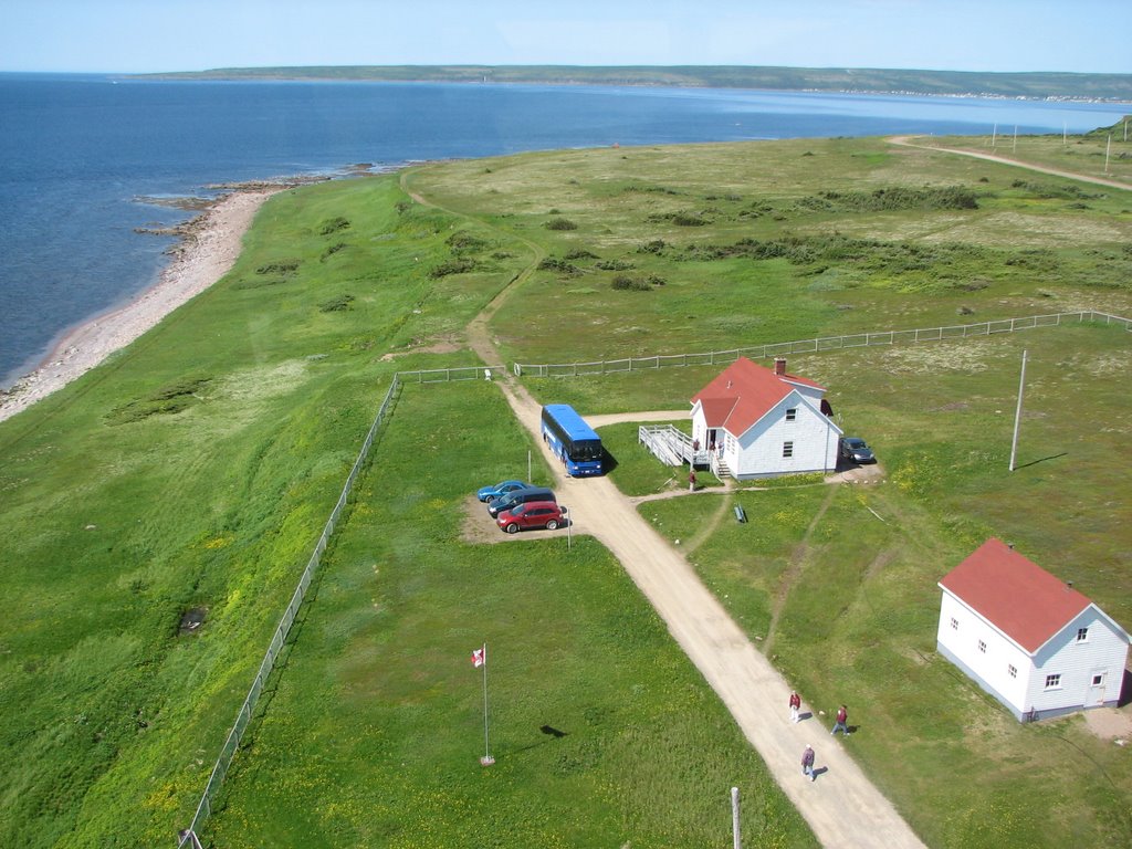
So, the race begins to end the caravan on time. Today was a 235 mile drive (point 1 to 2 on the map) from Louisbourg, NS to Truro, NS. We were here earlier in the trip but it was just a stop for the night place this time.  We did have an ice cream social the evening. Ice cream always makes everything better.
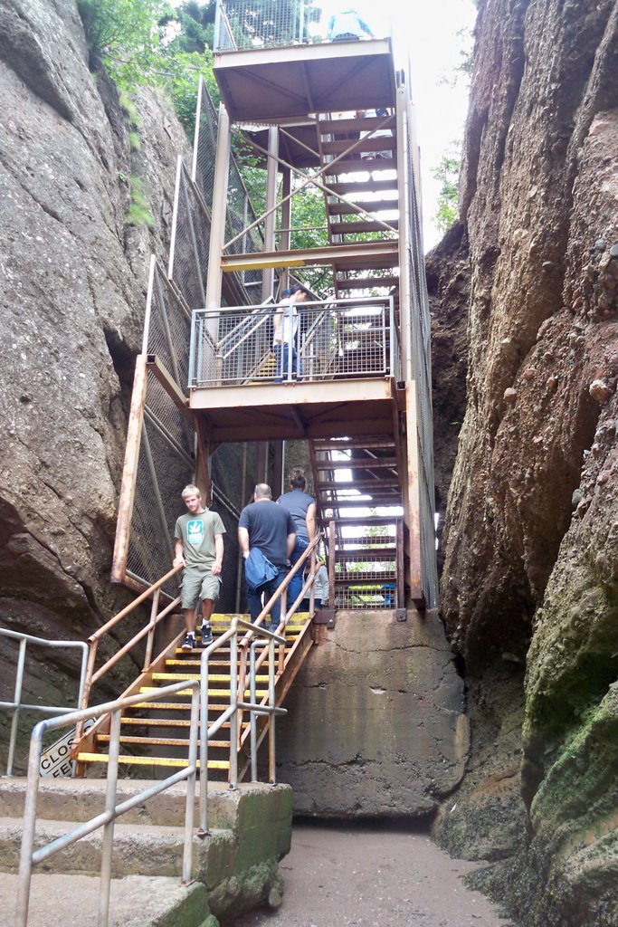
 Aug. 3, 2011.  The next morning our friends Herb & Ann joined us in leaving the campground at 6:00AM for a 125 mile drive to Hopewell Cape, NB (point 2 to 3 on the map). The reason for our early departure was the desire to get to Hopewell Rocks during low tide so that we could walk on the bottom of Chignecto Bay which is the most northern reaches of the Bay of Fundy. Here is where the “Flower Pots” are. The Flower Pots are sea stacks eroded at the base, with trees and plants growing on top. If you want read more about them go to: http://bayoffundy.com/articles/flower-pot-rocks/  We went to the park with our motor home and car, Herb pulled in with his truck & fifth wheel. Fortunately they have provided lots of parking for RV’ers and busses. It is a long walk downhill to the point where some 100 steps start down to the bottom. There are gas powered carts that you can ride for $2.00 per person. I would have gladly paid more for the ride back up the hill. Later that day when we came back to see high tide, we rode the cart both ways. Here are some pictures that show the how things change between low & high tide.
               4172.1  4172.


 For this set we couldn’t stand in the low tide location
                       
          4241.1 4241.2


In the first picture, you can see a rock with a hole in it that people can walk through. Here is a picture of Jackie standing in the opening. She’s the one in the maroon jacket and white slacks. It gives you an idea about how high that tide is.
4178
Jackie with Ann & Herb and a rock named ET.
                         4177 4216


There was a park ranger that was stacking rocks on one another. He was talking about how every rock has a balance point. He said that he stacks the rocks just for fun and to give the visitors something to try.
            4206 4207


 At the top of the stairway there is a clock and a posted time to return to the stairs so you don’t get caught by the rising tide. The return time of 1:05 was posted in the morning during low tide. I took this picture when we returned in the afternoon. They apparently do not change the time during high tide. Makes sense since you would be underwater at the bottom of the stairs. There is also information about what to do if you do get caught.
         4257 4258


4195P
More pictures of the rocks at Hopewell Cape are at: http://summer2011jb.shutterfly.com/pictures/3354


Aug. 4, 2011. Most of the caravan took their time leaving, those that missed low tide the day before went back to catch it before starting the 107 mile drive to St. John, NB (point 3 to 4 on the map) . 

Aug. 5, 2011. The next day we took a bus tour of St. John The first stop was at the Reversing Falls. These are rapids in a narrow gorge on the St. John River.  At low tide the water rushes downstream into the Bay of Fundy, however, at high tide the water from the bay pushes upstream causing the rapids to reverse the flow direction. The water velocity is constantly changing going from its maximum velocity to zero at tide reversal. There is about a 20 minute period when the water is still.
4267
This facility is a pulp mill owned by the Irving company. All through our trip we saw and patronized Irving gas stations. Our tour guide told us a little about the company. It is a privately owned company run by the two sons of the founder. They have many different business interests. Coming back through Maine, Vermont and New York I saw a few Irving stations so they have business interest in Canada as well as the US
4272
There are jet boat ride available. We were told that there are strict regulations for boat traffic
crossing this area. I don’t know how they apply to the people who run the jet boat rides. Downstream there is a bridge and just the other side is a restaurant that we had a group dinner at that night.
 
             4278 4276


Another stop we made was at the Carleton Martello tower. The plaque tells the important parts of its history. There was a diagram of the tower and surrounding fortifications showing how the harbor was to be protected.  It has been restored and you can go into the tower to see where the troops lived.
             4286 4287


                     4293 4289


                   4290 4291


4297
Later that day we had our “Farewell Dinner”. This wasn’t the entire group since some folks left the caravan before this. Actually it was the first farewell dinner because most of this group returned to the Pumpkin Patch RV Resort and we did it again. Anything for a “LEO”, which means “Lets Eat Out”
4301
When we arrived the incoming water was flowing rapidly under the bridge. There was a rock that we could see later that gives you an idea of how fast the water was flowing when we arrived and later what it was like just as the tide was starting to reverse.
        4303  4315


There were two boats that went upstream during slack time. A little while later you could see the start of the water starting to flow downstream (the curved line in the river) past where I was taking pictures from.
       4307 4313


After dinner we drove to the place where we took picture earlier that day.

Aug 6, 2011. We packed up and drove the 179 miles (point 4 to 5 on the map) to the Pumpkin Patch RV Park. At the US border there was a separate line for RV’s. It was mostly made up of folks in our caravan. When it was our turn they came on board and took some nectarines and a lemon. Although the caravan was officially over there were several of us including the wagon master and tailgunner that spent a couple of days there before heading our separate ways. It was the last hurrah, we had come full circle.

0205


Sunday 7 August 2011

30. Louisbourg, NS Rs

July 29, 2011. We started our day in L’Anse Aux Clair, NL. After a buffet breakfast at the motel we gathered our things and boarded the bus for the ferry. It was a short ride across the Strait of Belle Isle to St. Barbe and a couple hours later we were in our motor home driving towards Deer Lake, a distance of about 183 miles.
4039.1
July 30. 2011 was another travel day where we went 143 miles to Grand Conroy. That night we had a pot luck supper.

July 31, 2001. After a short 26 mile drive, we were at Port Aux Basque and the ferry terminal. Here we are in line at the Plant Quarantine Inspection Station. The provinces try to keep products out that may be diseased or carrying bugs, etc. The inspectors asked a few questions and then let us through. The ferry was new, put into service last year. We were talking to a local and he told us that this ship and the sister ship had to be shortened by 45 feet to fit into the docks here
                         4039.3 4042


After about two hour the boarding began. Once again there was very little room between vehicles. The ferry ride to Nova Scotia took between five and six hours.
4049  4051


After arriving and disembarking we had a 36 mile drive to the campground in Louisbourg. We stayed in Louisbourg two nights but we packed a lot into the time we had.

Aug 1, 2011. Fortress of Louisbourg. This fortress was important during the years 1713 to 1768 when the French and English were struggling to see who would control the land that is now Canada. The fortress was under control of both countries ay various times. The British captured the fort for the final time in 1758 during the Seven Years War after which it was destroyed by British engineers. In the 1960’s there was high unemployment in the coal industry. The fortress and approximately one fifth of the community was rebuilt to provide employment for the miners. The fortress is now operated by Parks Canada as a living history museum.  Many of the actors that play the parts of the soldiers and farmers are college students hired for the season.
4081 4087


              4085 4092


Close to noon there was a demonstration of marching, firing of the muskets and the canon.
During the performance we heard a turkey gobbling. We looked into an adjacent barnyard, as we watch the turkey peeked around the corner of a building as if to ask “Is Thanksgiving over?”
           4107 4108


                           4112 4114


At the fort’s bakery we bough a loaf of rye bread. The loaf was quite heavy for it’s size and still warm. Later that day there was a peanut butter & jelly party with bread from the fort courtesy of our Wagon Master.

As we looked across the bay we could see a light house and waves crashing on the rocks. After a stop for lunch we were on our way. Once again the scenery was spectacular.
                      4134 4144


4149P
The last stop was a railroad museum where artifacts for a bygone time were on display.
                4161 4163


That evening we went to the Louisbourg Playhouse to watch a local group perform. It is always impressive to see all the talent that people have. It seems to me that being a “star” vs a local entertainer is so dependent on being lucky.


Thursday 4 August 2011

29. Labrador

July  27-28, 2011


We drove from St. Anthony to St. Barbe where we stayed over night and took the ferry to Labrador the next morning. Since we were going to be in Labrador only that night and part of the next day we left the motor homes in the parking lot and walked aboard the ferry. There was a bus on the other side that would provide our transportation while we were in Labrador. The ferry station is in Quebec Province.
 There were a few trucks loaded before we were allowed to board. Walking on gave a good view of how the bow opens to take the vehicles on board. It looks like the bottom of the bow door is at the water line. There were a few jokes about good seals to keep the water out.
3913.2 3940


                   3946 3950


The first stop was at an ancient burial mound. The picture below plus those in the on-line album explains what is known about the site and who is buried there.

Since we were across the strait from Newfoundland there were ice bergs in the vicinity.
After a short stop at the burial site we went to the Point Amour Lighthouse. Built in 1851 it is the tallest lighthouse in Atlantic Canada at 109 feet. It is now a historic site open to visitors. There are128 steps, which we climbed to get to the top. Between the years of 1879 and 1963, three generations of the Wyatt family were its keepers. It is now fully automated, but back in those days the Wyatt’s had to climb the stairs every four hours to refill the fuel or pressurize the fuel tank. The light was like today’s Coleman Lantern only larger.
                                 3998 3980


The original lantern light has been replaced with a 100 watt bulb. There are four bulbs, with one being used and three spares that can be rotated to the proper operating position should the one in use fail. The lens is original although some of the elements have bee replaced due to being chipped and broken over time.
                3996 3993


Looking down we saw a strange rock formation, which we were told, was a fossil bed. Our bus looked rather small from the top. The square concrete pads were the remnants of the fog horn
                     3987 3990


3976c
After lunch we went to Red Bay Labrador where the Basques hunted right and bowhead whales in the 16th century. This area is a National historic Site. In 1978 a wreck was located in the harbor which was believed to be the San Juan, sunk in 1565. The pieces of the ship were mapped, brought to the surface for study, then returned to their original positions at the wreck site. While exploring the wreck they discovered another smaller, whaling boat known as a chalupa was under the San Juan. It was brought to the surface, preserved and is on display.
                            4013c 4011


4014
There was another wreck in the harbor. It Happened about 40 years ago so it is considered to be a modern wreck.
4006
We are nearing the end and our pace is accelerating. We have several days that are travel and sightseeing combined.Gotta rush.